Southern California's latest winter storm is on its way out, though you might still see brief periods of heavy downpours before things wrap up on Thursday.
Heavy showers started early on Tuesday, followed by strong winds. Downtown L.A. saw an inch of rain, while some mountain areas saw as much as two feet of snow.
This storm was exceptional for a number of reasons, not the least because we saw tornadoes touch down in both Santa Barbara and Los Angeles counties.
People in Carpinteria experienced extreme weather that damaged 26 mobile homes! @NewsChannel312 @TracyLehrNews #CAwx #StormWatch pic.twitter.com/spTpDNEEYB
— Ryder Christ (@RyderChristNews) March 22, 2023
The first tornado struck Carpinteria on Tuesday, damaging mobile homes in the area with 75 mile per hour winds.
While we see tornadoes — specifically landspouts and waterspouts — once or twice a year, rarely do they cause this much damage. The last time the Oxnard office of the National Weather Service had to classify a tornado was in 2016.
We've received lots of questions regarding what is a landspout vs. a tornado. A landspout IS a tornado. It usually causes less damage than a "typical" tornado. Check out this Weather-Ready Nation graphic explaining the differences of a couple different tornado types. #CAwx pic.twitter.com/d235TUXXlM
— NWS Los Angeles (@NWSLosAngeles) March 22, 2023
The second incident occurred Wednesday, when a tornado touched down in an industrial area of Montebello.
Videos show a funnel forming, debris flying through the air, and the roofs being torn off commercial structures.
Here's another look at the possible tornado that formed over Montebello, tearing up the roofs on multiple industrial buildings, damaging cars and injuring at least one person. 🌪️😨 Watch live coverage now: https://t.co/0YmyVrcwhu pic.twitter.com/T9X7GumZ2t
— ABC7 Eyewitness News (@ABC7) March 22, 2023
Two large commercial buildings sustained significant damage, a 40 foot tall pine tree was knocked over and one person was sent to the hospital with minor injuries, according to Michael Chee, public information officer with the City of Montebello.
Overall, the destruction spread across about half an acre.
"It was very intense. It was very brief. Also fairly destructive," Chee said.
@KTLA @ABC7 tornado/twister in montebello pic.twitter.com/dwbxGYVdqY
— Big Rob (@TheRedRanger23) March 22, 2023
We've got more information on the tornadoes and why it took so long for the NWS to declare that they had occurred.
What's next
Temperatures will remain cooler than average over the weekend.
We could see another storm Tuesday or Wednesday of next week, though the forecast is far from certain.
Records broken
Tuesday's heavy downpour broke daily rainfall records.
There were 5 daily rainfall records broken yesterday, March 21st. Downtown L.A. broke it's 130 year record set in 1893.#CAwx #socal #LArain #LAcounty #Losangeles #LAX #LAwx pic.twitter.com/8a120Sp8O6
— NWS Los Angeles (@NWSLosAngeles) March 22, 2023
“We’re much above normal for rain, it doesn’t matter where you look up and down Southern California," said Alex Tardy of the NWS. "The values for March are already well above average, so this is going to end up being on the books as a much-above normal rainfall season."
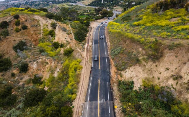
Road closures
- You can search the latest road closures via CalTrans here and download an app to receive push notifications here.
- State route 189 in Lake Arrowhead is currently closed due to possible erosion issues and wall complications according to Caltrans officials. The stretch of road closed is from North Bay Road to State Route 173. Caltrans officials are evaluating the damage and are advising drivers to take State Route 18 to State Route 173 to get to Lake Arrowhead Village.
- State route 18 is closed from Upper to Lower Waterman Canyon due to rock slides. Caltrans recommends cancelling travel down through the area, though travel up the mountain is unaffected.
Weather advisories
- A winter storm watch is in place until 11 p.m. Wednesday for inland areas of Southern California.
- There's also dangerous surf at the beaches, with a high surf advisory is in place for Ventura and L.A County beaches until 5 a.m. Thursday.
Evacuation maps
A list of maps that should display evacuation warnings and orders when they're issued:
What to know about flood warnings
Here's an excerpt from our guide to understanding flood warnings:
- Flood advisories are how the NWS begins to raise the alarm. The goal is to give people enough time to take action.
- Flood watches are your indicators to get prepared to move.
- A flood warning is issued when a hazardous weather event is imminent or already happening. When one is issued for your area, you need to get to higher ground immediately.
- A flash flood warning is issued when a flash flood is coming or in progress. Flash floods are sudden and violent floods that can start within minutes.
Read more: Flash Flood Warnings? Watches? Here’s What You Need To Know
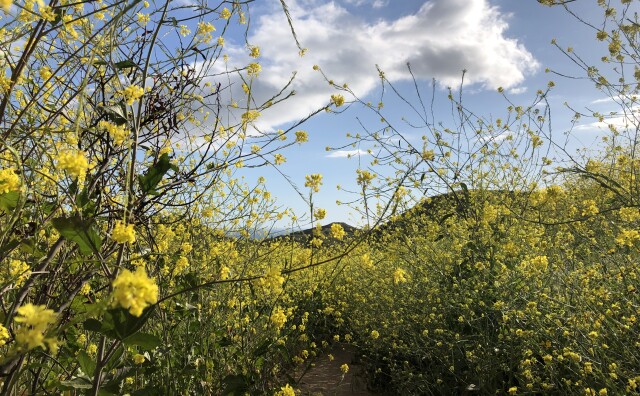
How's California doing on water?
The February and March storms went a long way towards saturating parched soil, filling reservoirs and increasing snowpack to historic levels.
According to the U.S. Drought Monitor, much of the state has had its drought conditions alleviated, though there are big chunks that are still quite dry.

- Reservoir conditions: slightly below average, though they will fill as the year goes on
- Statewide snowpack (important store of water during dry months): 225 percent of normal for this date.
- Rainfall across CA: 27.22 inches or 147 percent of normal.
- Rainfall in L.A.: 31.76 inches or 198 percent of normal.
- Most of Orange County has seen more than an inch rain
- Most L.A. County areas have also seen an inch of rain or more.
- You can see all the latest rain and snow totals across the state here.
Driving in the rain
-
Advice on driving in the rain:
-
- Check weather and road conditions all along your planned route
- Slow down
- Keep a wider-than-usual distance between your vehicle and the one in front
- Don't drive through standing water — as little as 12 inches of rushing water can carry away most cars, and two feet can carry away SUVs and trucks.
- Make sure tires are fully inflated
- Check windshield wiper blades and replace if necessary
How to stay safe in thunder and lightning
-
You should be safe indoors during a lightning storm, but there are still dangers. According to the Centers for Disease Control and Prevention, about one-third of lightning-strike injuries actually occur indoors. Here are some tips from the agency to keep you safe at home:
-
- Avoid water. Don't bathe, shower, wash dishes, or have any other contact with water during a thunderstorm because lightning can travel through a building’s plumbing.
- Don’t touch electronic equipment. Don't use anything connected to an electrical outlet, such as computers, laptops, game systems, washers, dryers, or stoves. Lightning can travel through electrical systems, radio and television reception systems, and any metal wires or bars in concrete walls or flooring. Surge protectors can help avoid this.
- Avoid windows, doors, porches, and concrete. Don't lie on concrete floors or lean on concrete walls during a thunderstorm because lightning can travel through any metal wires or bars in concrete walls or flooring.
- Don’t use phones with cords. It is safe to use cordless or cellular phones during a storm.
-
It's best to avoid the outdoors entirely during thunder and lightning storms. — hence the phrase “When thunder roars, go indoors.” If you can't get inside a building, staying in a hard-top vehicle with the windows rolled up works too.
-
But if you can't avoid being outside, here are some safety tips:
-
- Immediately get off elevated areas such as hills, mountain ridges, or peaks.
- Never lie flat on the ground. Crouch down in a ball-like position with your head tucked and hands over your ears so that you are down low with minimal contact with the ground.
- Never shelter under an isolated tree. If you are in a forest, shelter near lower trees.
- Never use a cliff or rocky overhang for shelter.
- Immediately get out of and away from ponds, lakes, and other bodies of water.
- Stay away from objects that conduct electricity (such as barbed wire fences, power lines, or windmills).
- Separate from others. This will reduce the number of injuries if lightning strikes the ground.
- If you are out in the open water and a storm rolls in, return to shore immediately. If caught in a storm in a small boat with no cabin, drop anchor and get as low as possible.
- Don’t stay in open structures.Avoid open structures such as porches, gazebos, baseball dugouts, and sports arenas. These structures won’t protect you from lightning.
- Stay away from open spaces such as golf courses, parks, playgrounds, ponds, lakes, swimming pools, and beaches. Seek shelter immediately.
- Stay away from tall structures, such as telephone poles and trees; lightning tends to strike the tallest object around.
-
Here are additional tips from the American Red Cross in both English and Spanish:
How to stay safe in high winds
-
- Watch for traffic signals that may be out. Approach those intersections as four-way stops.
- Make sure you have a battery-operated radio and flashlights. Check the batteries to make sure they are fresh. Use flashlights for lighting during a power outage; do not use candles because they may pose a significant fire hazard.
- If you’re in a vehicle with a fallen power line on it, stay in the vehicle and remain calm until help arrives. It is OK to use your cellphone to call 911. If you must leave the vehicle, remember to exit away from downed power lines and exit by jumping from the vehicle and landing with both feet together. You must not touch the vehicle and the ground at the same time. Then proceed away from the vehicle by shuffling and not picking up your feet until you are several yards away.
- Water and electricity don’t mix. Water is an excellent conductor of electricity. Do not step in or enter any water that a downed power line may be touching.
- Do not use any equipment inside that is designed for outdoor heating or cooking. Such equipment can emit carbon monoxide and other toxic gases.
- If you use a generator, place it outdoors and plug individual appliances directly into it, using a heavy-duty extension cord. Connecting generators directly to household circuits creates “backfeed,” which is dangerous to repair crews.
- Leave the doors of your refrigerator and freezer closed to keep food as fresh as possible. Place blocks of ice inside to help keep food cold. Check food carefully for signs of spoilage.
- Check on your neighbors to make sure everyone is safe.
Tips to keep your heating bills down
-
State law requires residential units to have heating systems that can keep indoor temperatures at a minimum of 70 degrees. That means every dwelling unit and guest room offered for rent or lease should offer heating equipment, usually central air conditioning (A/C) or a wall heater. — Caitlin Hernández
-
Use heat smartly to save money: Cranking things like the A/C and wall heaters can be expensive. If money is tight, be judicious about how and when you use your utilities. For example, only use heaters at night or only set the thermostat to around 70 degrees.
-
Open and close those vents: If you have central A/C, look at where the vents are around your home. Are any open in places where you don’t stay long? Practice opening and closing those so warm air only goes where you need it (most vents should have a small toggle lever). Humidifiers can also help you warm things up — and it’s useful to add moisture into our dry air.
-
Adjust your wall heaters: If you have a wall heater, you can change the output by adjusting the knob (usually at the bottom). Since wall heaters can only warm the areas where they’re placed, it’s essential to close doors to rooms you won’t be in so hot air doesn’t get wasted.
-
Turn on your ceiling fan (really): If you have a ceiling fan, try turning it on. This sounds counterintuitive, but there’s science behind it. The direction a fan turns can push air in different directions, and since hot air floats up, you’ll want to move that around. Your fan should spin clockwise to create an updraft to circulate. Not all fans will have this option, though.
Additional storm resources
-
Here's what you need to know when storms hit Southern California:
-
- Tips To Stay Prepared For The Next LA Storm
- Mudslides Can Be Dangerous And Destructive. This Is How You Can Prepare
- Storms Can Bring Lots Of Water — But Much Of It Winds Up In The Ocean
- Your Guide To Driving Safely In The Rain In LA (And Really Anywhere)
- How LA County Prepares For Massive Rainfall — Like The Storm Hitting Us Now
- Flash Flood Warnings? Watches? Here’s What You Need To Know
- Why Atmospheric Rivers Can Be A Blessing And A Curse