One of Los Angeles’ oldest green spaces, MacArthur Park, is on its way to being made whole again.
A multi-year effort has started to reconnect the 35-acre recreation area that’s currently bisected by Wilshire Boulevard. But why was the park split in half nearly a century ago?
MacArthur Park origins
Before it was public parkland, today’s MacArthur Park wasn’t a popular place. In the early days of L.A., in the 1800s, it was a marshy wetland that was dismissed as an undesirable swamp, according to historian Nathan Masters, as the land occupied a saddle-shaped depression.
-
It's gonna be Yankees v the Boys in Blue
-
Nonprofit's launching fundraiser to keep it afloat
-
USC study documents what residents want from trees
The body of water was a natural alkali lake, which created a very productive ecosystem with plenty of waterfowl. That evaporated for a time in the extended 1860s drought, giving the area a bad reputation, and it prompted the public to dub the space the “Dead Sea,” according to a city planning survey.
-
There’s a song named after the park, which you can listen to here by musician Richard Harris. Don’t leave the cake out in the rain!
The city tried to sell it off for a bottom-barrel price, but it failed to draw any interest. The land then went from swamp to dump as people piled trash and animal carcasses rotted away. But after Angelenos began to move to the Westlake neighborhood around it, they campaigned for improvements, and it transformed over the years.
In 1886, the area was designated as public parkland, first named Westlake Park, which took it from an eyesore to an oasis (or at least as nice as you can get for a city), complete with buggy paths, boating facilities, a bandstand for Sunday concerts, and a seal pool! (Yes, actual living seals to gawk at.)
Fresh water was pumped into the lake from the city’s Zanja Madre water system, which reduced its alkalinity.
In 1942, the city of Los Angeles changed Westlake Park’s name to what we know today, in honor of General Douglas MacArthur.
Split in two


As L.A. grew through the decades, so did our transportation routes.
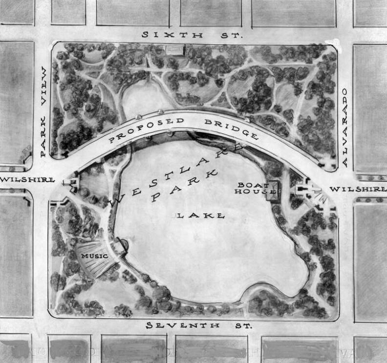
At that time, Wilshire Boulevard, a major east-west artery, dead-ended 1.5 miles west of downtown at the park. It was millionaire Gaylord Wilshire’s dream for his namesake boulevard to connect downtown to Santa Monica, so the city had been looking for ways around the park into downtown since the late 1920s.
There were proposals drawn up to achieve this through other means, like a $250,000 plan to build a bridge over the lake, but in the end, the city chose a cheaper option — simply extending the road, at $93,000 (equivalent to $2.1 million today).

The cut-through change wasn’t welcomed by all, however. The Wilshire Community Council protested the move in 1932 and residents organized to urge city leaders to stop. In October of that year, 300 residents went before the Public Works Committee of the City Council to voice a unanimous dissent.
Speakers felt the change was an unnecessary one that would destroy the park, bring traffic hazards closer to visitors, and be a “drain on the public purse.”
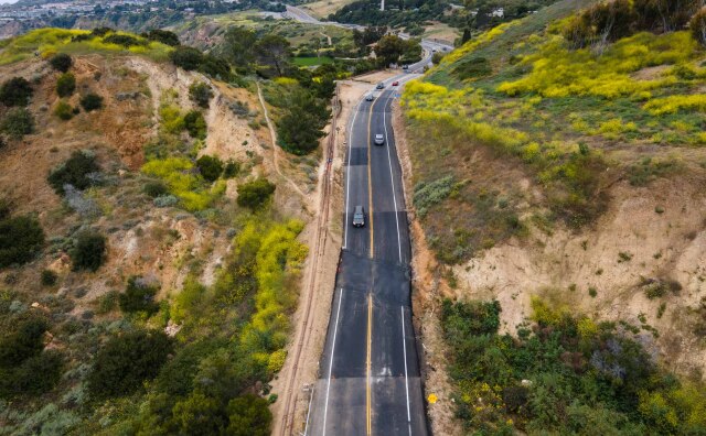
But the city moved forward, and in 1934, they constructed the road that took Wilshire Boulevard into the park, through the lake, to the other side. The lake was drained temporarily as teams filled in the dirt foundation.
At the time, the road it connected to was Orange Street, but it was all renamed to Wilshire later.
Today's concerns
The contentious history mirrors issues with the management of MacArthur Park today, with concerns that it isn’t well taken care of.
In 2021, the park closed down for a million-dollar repair, displacing the unhoused people living there. And there are also crime worries. Just recently in June, a body was found in the lake.
The city leaders spearheading the merging of the two park sides believe that closing the causeway will bring a refreshed effort to improving the park after “years of neglect.”