Topline:
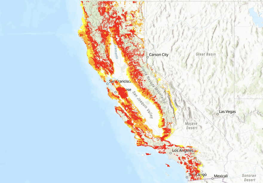
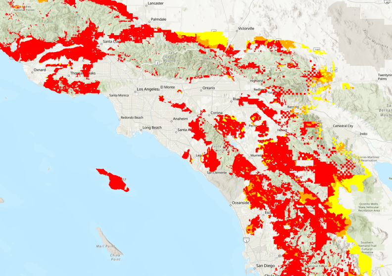
After more than a decade, the Office of the State Fire Marshal just released its latest version of its Fire Hazard Severity Zone map, making it available for public comment. The map shows what Californians already know: our fire hazard has increased across the state, in part due to climate change.
Why it matters: This map was last updated in 2007. Since then we've seen the largest, most destructive, and deadly fires on record, and this new map shows that the frequency and severity of wildfires has worsened in lots of areas. This map is important because it acts as an official, publicly available record, of the likelihood that an area will get hit by wildfire.
View the map: It's available on Cal Fire's website. You can use the slider to see which areas have changed.
The map's limitations: This map only includes updates to State Responsibility Areas. So places like Coffey Park, which burned down in Sonoma's 2017 Tubbs Fire, are not rated as very high risk because it's in a Local Responsibility Area. Those areas still need to be updated.
What's next: The public comment period will be open for two months. After the new map is adopted, the process of updating fire hazard in Local Responsibility Areas will move forward.
Go deeper: We go deep on this issue — and why you'd even bother rebuilding in a town that's burned down before — in Episode 7 of The Big Burn podcast.
